Governments and weather agencies have been operating imaging satellites for decades. Data from these satellites is aimed at aiding the working of various industries, ranging from infrastructure monitoring to agriculture. Today, many startups are competing to change the scenario by working on commercial satellites.

Initially, the issue with most commercial satellites was that, clear imagery could be obtained only in broad daylight when the weather was pleasant, and devoid of clouds and other harsh circumstances. Alternative solutions were heavy and expensive. Capella Space, a US aerospace and information services company founded by Payam Banazadeh and William Woods in 2016, solved this gap in reliable and consistent satellite coverage through commercialisation of synthetic aperture radar (SAR) technology for its radar Earth observation (on-demand) micro-satellites.
After the stop-work order issued due to lack of funding was lifted in 2017, Capella resumed its Defense Innovation Unit Experimental (DIUX) work. In March 2018, it received a licence from National Oceanic and Atmospheric Administration to send two x-band (9.4GHz to 9.9GHz) SAR satellites into polar orbits between 450 to 600 kilometres with a 97.5-degree inclination.
The startup launched its first commercial SAR microsatellite, Denali (Capella 1/SpaceCap), via SpaceX Falcon 9FT Block 5 rocket out of Vandenberg Air Force base in California under Spaceflight’s SSO-A rideshare mission the same year. The satellite, named after the tallest mountain in the US, is only for testing the adopted technology and making improvements in the future accordingly.
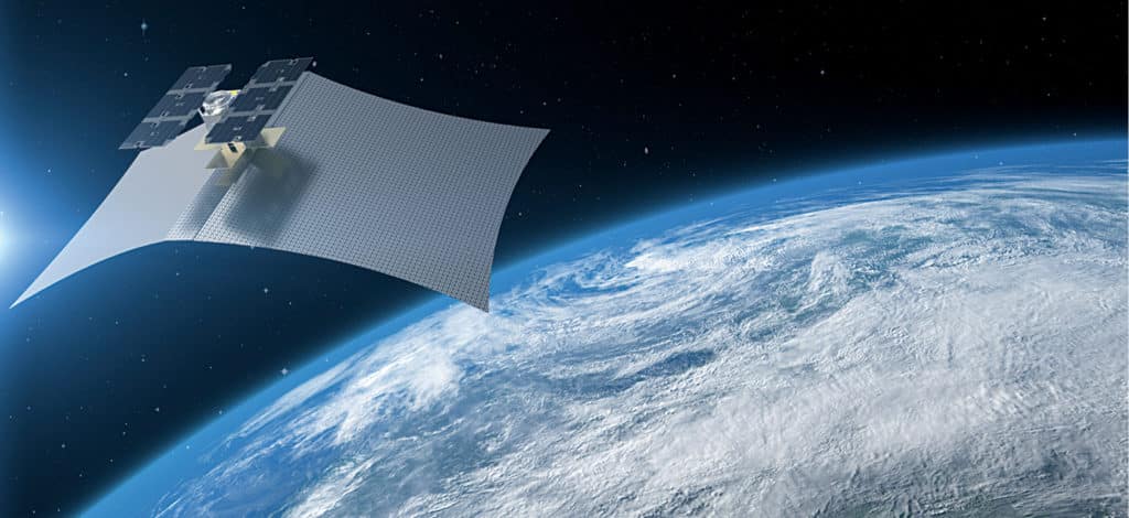
Weighing less than forty kilograms, the satellite is powered by solar cells and batteries. It unfolds a high-resolution radar antenna from a backpack-sized payload to nearly 9.3 square metres (hundred square feet), with integrated electronics to detect sub-meter changes on the surface of the planet. It is controlled from the command centre in San Francisco.
SAR technology works on active imaging for which large antennae send a signal and measure how it is received back from Earth. This consumes more energy and, hence, the power supply needs to be properly managed. As compared to a conventional satellite, deployment is cost-effective because of the presence of small-sized components built from scratch.
Using proper algorithms, data obtained from the sensors is used to obtain Earth’s information persistently, to make decisions worldwide. In January 2019, Denali averted a possible collision and, thereby, a huge amount of debris when another satellite travelling at a relative speed of nearly fifteen kilometres per second (33,500 miles per hour) passed close by. The company had to raise the orbital altitude within a span of two days to solve this issue.
This is not their only satellite mission. The startup recently purchased six Phase Four’s—a provider of electric radio frequency (RF) thrusters—Maxwell engines as its propulsion solution for its initial phased deployment of a constellation of 36 microsatellites, consisting of twelve polar orbits. The purpose is to deliver persistent, reliable, inexpensive radar data anywhere on Earth within a few years, which has not been possible with pre-existing optical counterparts so far.
As a part of this deployment, an improved high-resolution satellite, Capella 2 or Sequoia, will be used to provide SAR imagery. Rest of the deployments will begin from 2020, starting with Whitney Constellation. With this, the time to revisit any point on Earth will gradually reduce to one hour. To deliver hourly imagery as rapidly as possible, it has chosen to become one of the first customers of the newly-launched Amazon’s satellite ground network.
As the number of satellites increases, there is a need to come up with strict regulations to solve the problems surrounding space debris. Once this happens, there will no longer be limitations in viewing any sort of vital information from space.


