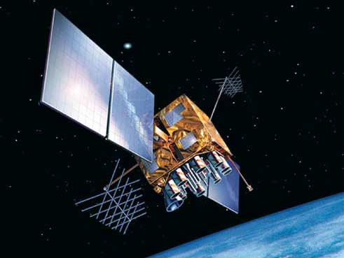
The global positioning system (GPS) is a satellite-based global navigation satellite system (GNSS) that provides various types of information including geographic location, latitude, longitude, altitude, time, etc. It is a reliable system, which is unaffected by weather and time. Anyone can freely access it with a GPS receiver.
GPS receiver
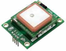
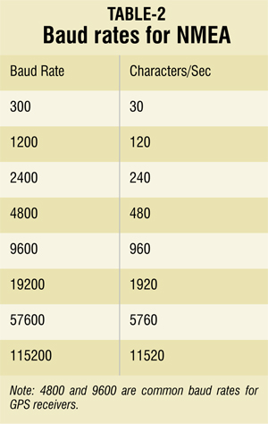
GPS receiver is a device that receives GPS signals for determining the device’s current location on earth. The communication method of the receiver is serial. The serial data can be read through receive and transmit buffers by any embedded system or computer via RS-232 or USB. Mostly Garmin GPS receivers are available in markets and these use NMEA protocols.
NMEA protocol
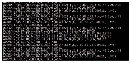
It is a protocol that defines the transmission of data in the form of sentences from one source to unlimited number of listeners. The GPS receiver receives the information from satellites using NMEA. Important protocol rules are:
1. Message starts with a dollar ($) sign.
2. Information about message and source is carried by next five characters.
3. Data fields are separated by comma.
4. Null bytes mention unavailable data.
5. ‘’ at the end of the message.
Important message types of NMEA include:
Global Positioning System Fix Data (GGA). Time, position and fix related data for a GPS receiver.
Geographic Position—Latitude/Longitude (GLL). Latitude and longitude, UTC time of fix and status.
Satellites in view (GSV). Number of satellites in view, satellite ID (PRN) numbers, elevation, azimuth and SNR value.
Recommended Minimum Specifc GNSS Data (RMC). Time, date, position, course and speed data.
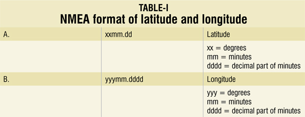
Latitude and longitude conversion
Conversion to decimal system:
Latitude = xx + ( mm.dd/60 )
Longitude = yyy + ( mm.dddd/60 )
Software tools for GPS receivers
Various software tools are available for GPS receivers. These tools communicate with receivers, read the NMEA messages and give the required output. For example, latitude, longitude, altitude, numbers of satellite, etc.
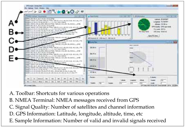
GPS Cockpit is one of the software that is used widely. Here, we see how to use it.
How to connect
To connect a device follow the steps mentioned below:
1. Connect the device to the appropriate serial/USB port.
2. Select connect button from toolbar.
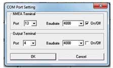
3. Select ‘Port’ and ‘Baudrate’ (4800/9600 generally) in ‘NMEA Terminal.’ Do not select any output terminal if you do not want to use NMEA messages further.
4. Wait till GPS receiver responds. It may take 10-15 minutes.
5. For disconnecting select button from toolbar.
Navigation and GPS
Navigation is the most important application of GPS. The process of monitoring and controlling a vehicle, craft or a person from same or different places is termed as navigation.
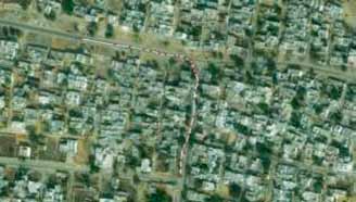

To perform navigation, GPS data or GPS receiver is not sufficient. We have to use some geographic information system (GIS) that provides a platform on which the GPS data can be seen. GIS is a system by which we can create, visualise, analyse and query geo spatial data. The geo-spatial data involves geographic information like coordinates, latitude, longitude, geographic location, spatial geometry, map data, etc. The GIS system has various other usages and applications regarding geo-spatial data. There are two types of geo-spatial data:
Raster data. Digital imagery or air photos are the most basic form of raster data. Map can also be represented as raster data.
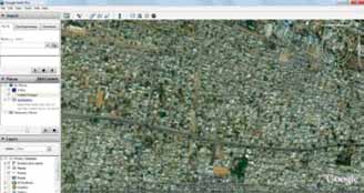
Vector data. Vector data is contained by a layer, super-imposed on the raster layer. Point, line and polygon are three types of vector data. These are maintained by users to create something on the map including village points, rivers, roads, etc, on the raster layer.
GIS can be classified into two categories
Online. It uses Internet connection to use spatial data. For example, Google Earth and Google Maps.
Offline First a spatial data is created and then used. For example, ArcGIS and Quantum GIS.
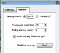
Live navigation using Google Earth
This is an online type of navigation. Internet connection is necessary to view maps and other geo-spatial data. Here we will see the online navigation in a few steps:
1. Run Google Earth. Connect your GPS receiver to appropriate USB/serial port.
2. Go to ‘Tools’ → GPS.
3. Click on ‘Realtime’ tab. Select NMEA, don’t forget to check ‘Automatically follow the path.’
4. Click on ‘Start’ button. It automatically detects the GPS receiver, processes data and takes you to the position of GPS receiver.
The author is a co-founder of Robo India, a leading robotics company


